Smoke Forecast for Sep 21, 2022
Ground level concentration of particulate matter 2.5 microns and smaller (PM2.5) in units of micrograms per meter cubed (µg/m3).
The BlueSky Canada smoke forecast is our current best estimate of when and where wildfire smoke events may occur over the next two days. The map may not agree exactly with local smoke concentrations and timing, and should be used with care. For additional information please consult the FAQ.
| Forecast ID: | BSC00CA12-01 |
| Run date: | 2022-09-21 |
| Run time: | 08:00 UTC |
| Meteorology: | WRF 2022-09-21, 12km grid, 00 UTC initialization |
| Fires & emissions: | 2022-09-19 08:00 UTC |
| Carryover smoke: | 2022-09-21 02:00 UTC |
Disclaimer
This BlueSky Canada smoke forecast is considered experimental because it is produced by a modeling system that is an ongoing research project and subject to uncertainties in fire data and emissions, weather forecasts, and smoke dispersion. The system uses satellite detections to locate fires; if cloud cover or smoke obscures the detection of fires from space, the resulting emissions from these fires will not be included in the smoke forecast.
NOTE: This forecast does not include smoke from sources that are outside the boundaries of the forecast domain. The BlueSky framework currently does not have a mechanism to transport smoke into the model domain from external sources. Please use the Canada-wide forecast to evaluate whether long-range smoke transport may affect your region.
Downloads
| Google Earth KMZ file: | dispersion.kmz |
| Raw data NetCDF file: | dispersion.nc |
Previous Forecasts
Tools
Playground
If you have a local event not currently captured in the BlueSky smoke forecast, consider using our Playground ad hoc smoke modelling tool. Playground allows you to create emissions scenarios for wildfires, prescribed burns and pile burns, then model and view the resulting smoke dispersion.
View the Rapid Response Smoke Forecasting with Playground tutorial for more information on how to use Playground.
Current location & zoom
If you have panned and/or zoomed the map, here is a URL with the current latitude, longitude and zoom level:
Copy this URL and bookmark it in your browser to be able to easily return to the forecast for this location.
Help
 |
Click the Layer control and click one of the alternate styles to switch basemaps. |
|
Click the Layer control and click one of the Forecasts to switch between hourly, daily average and daily maximum smoke forecasts. Note: daily forecast values correspond to a UTC (Z) day. |
|
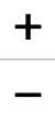
Click the Layer control and click the checkboxes to toggle the display of the Overlay layers. |
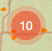 |
When the hotspots layer is visible, click on a Marker Cluster to zoom in and view individual hotspots.. |
 |
Click the Zoom controls to zoom the map. Click and drag the map to pan. |
 |
Click the Fullscreen control to enable fullscreen view; press the 'Esc' key to return to normal view. |
 |
Click or drag the Opacity slider to change the opacity of the forecast layer. |
 |
Click the Pause/Play control to pause and resume the forecast animation. |
  |
When paused, click the Forward and Back controls to step through the forecast. |
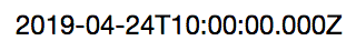 | |
| Click the DateTime control to switch between UTC (Z) and local time. Note: local time is based on your device and/or browser settings, not the time zone of the map currently being displayed. | |
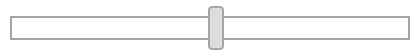 | |
| When paused, click or drag the Frame slider to jump to a different forecast hour. | |
 | |
| Drag the Speed slider to change the frame rate of playback (in frames per second). | |